 | |||
 | |||

|
The Allman Brothers (first album, 1969) - Album cover photo location - 315 College Street, Macon, Georgia. The Allman Brothers Band - album cover 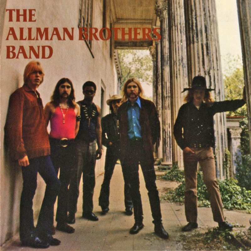
(photo by Stephen Paley)
Where it was photographed, in a photo taken in 2013. 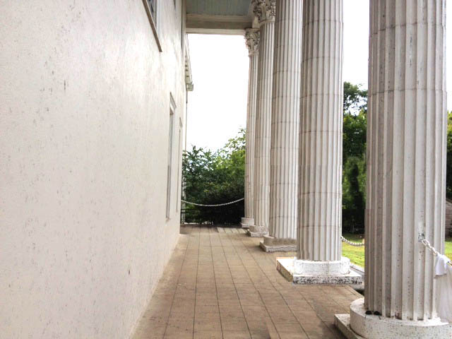
(photo by J.T. Wang)
Now with the album superimposed over the exact spot in PopSpots style. 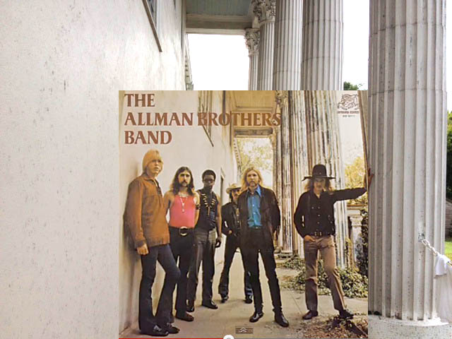
(inset photo by Stephen Paley)
And from further back, with the cover on the right for reference. 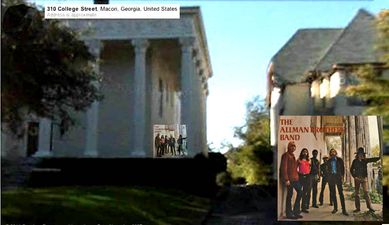
(inset photos by Stephen Paley)
And now, as if it might have looked as the photographer walked up the front lawn... 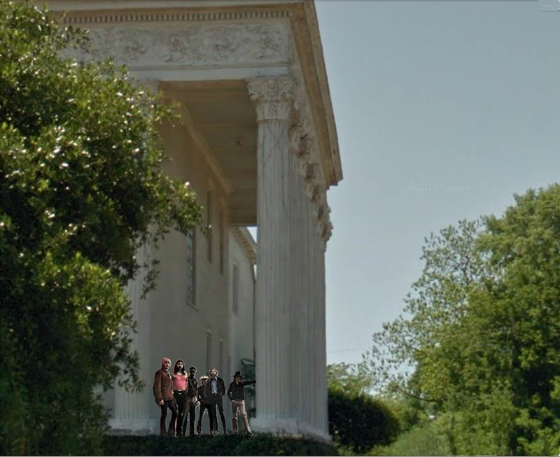
(band photo by Stephen Paley)
FINDING THE EXACT LOCATION AND GETTING THE PHOTO This PopSpot was relatively easy in that I had read that the Allmans' first cover was taken at 315 College St. in Macon, Georgia - and that's easy enough to find on Google Street views. But where, around the all-white house, was it taken? 315 College Street (often known as the Beall House - a former restaurant), if one does a little research through Allman fan sites, is the large mansion next to 309 College Street, the large house that the Allman Brothers first lived in when they came to Macon in 1969. That house, #309, can be partially viewed on the right in this picture. The album shoot location, the Beall House, is on the left. 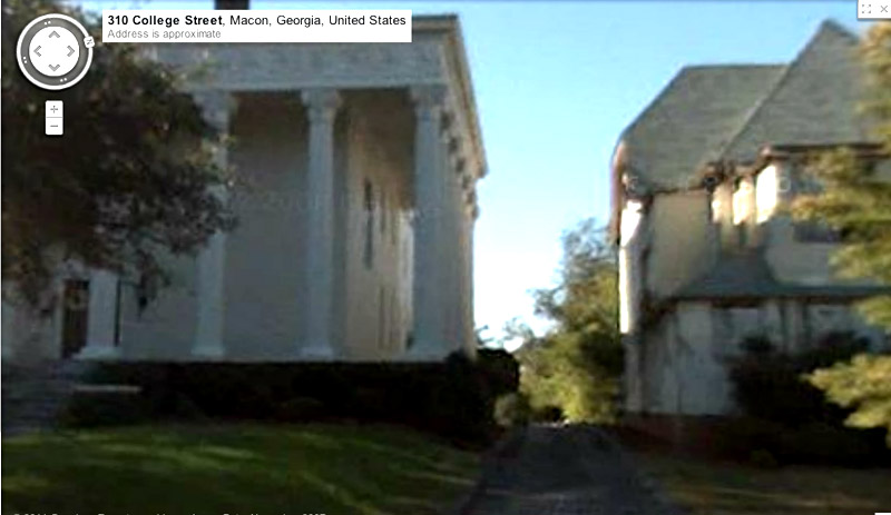
Here's a shot of the Allman Brothers' first house in Macon (309 College Street), from above. (It's in the red circle.) According to Allman roadie "Red Dog" in an interview in the Washington Post about this location: "There were 10 of us living there. We didn't have anything but mattresses, a trip light, a stereo, and a Coke machine filled with Pabst and Bud. Ah, those were fun days." 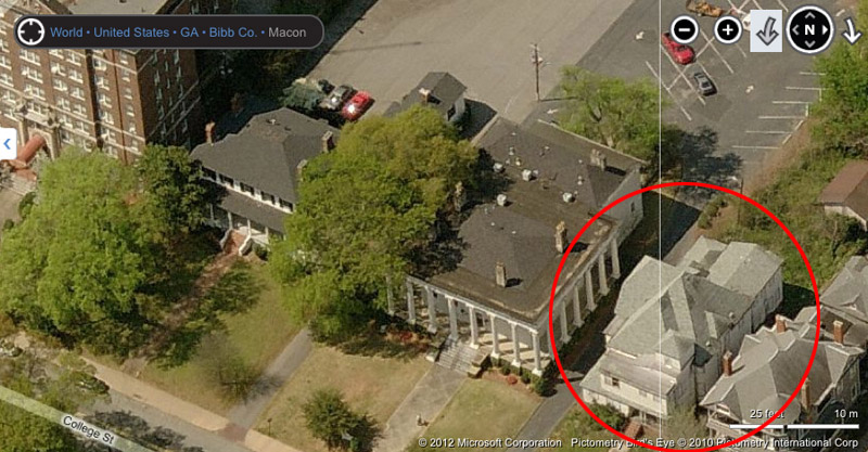
Since that photo, the building has been taken down. All that's left of that house is this Allman Brother "mushroom" logo on the front sidewalk. (I'm not sure when it was put there.) 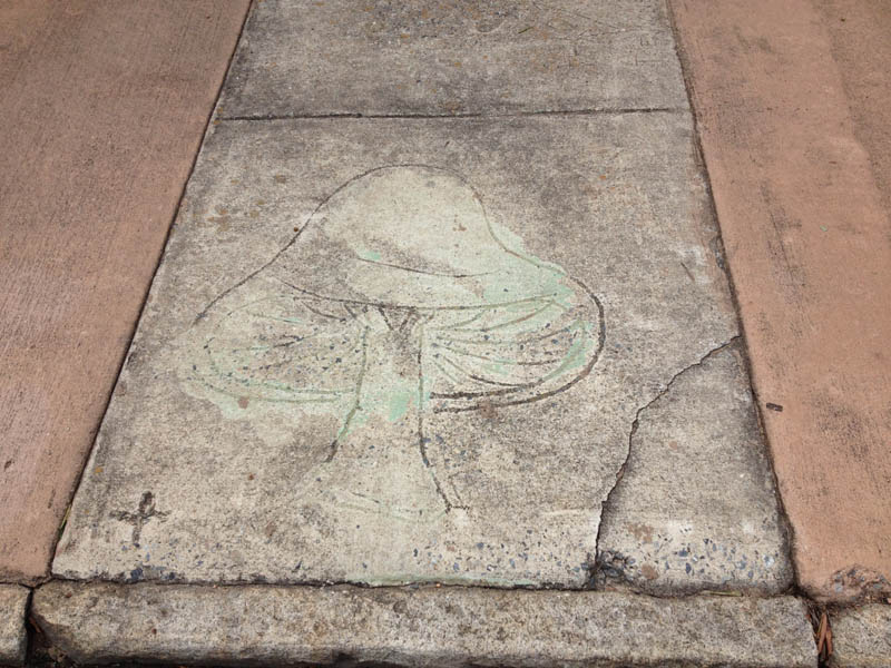
Here, to the right, behind the tree, is where the house would have been. And the sidewalk in front is where I am assuming the mushroom logo was embedded into the concrete, as the photo was sent to me just indicating: "I took the picture on the sidewalk which once led to the house." 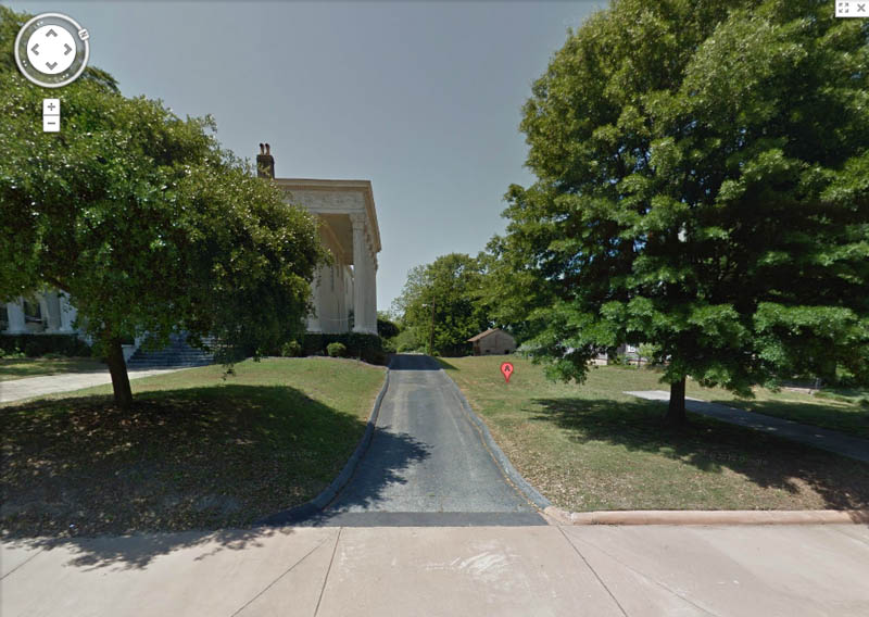
This is a front-on picture of the Beall House, which, as we learn in this photo caption, is now becoming a learning center for string instruments (violins, violas, cellos, double-bass) as part of Mercer University. What's striking is that there are windows on the left of the facade, and none on the right. I had originally figured that the Allman Brothers were filmed on the front porch of this building, but in the Allman photos, there were no ground-level windows to the left of the band. Thus, the photo must have been taken around the porch to the right. 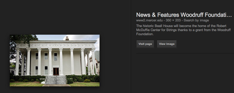
Here's a Bing's Eye-view down at the side of the house. You can see the large blank wall and high window that was in back and above the band. 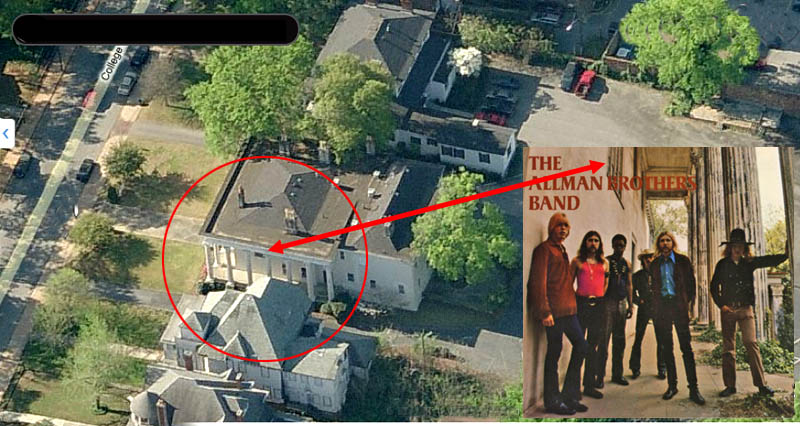
(inset photo by Stephen Paley)
Now, using Google Street View, this was as close as I could get to the side of the house. It really didn't line up to make a great PopSpot, because of the angle and the distance... 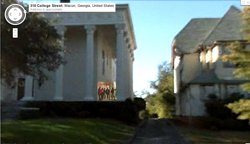
(inset photo by Stephen Paley)
...But then, out of the blue, I get an email from an Allman Brother's fan named J.T. Wang who had just visited Macon, and had a picture taken of himself, in the exact spot that I needed a picture taken from! How lucky was that? Thanks,J.T.! Here's J.T. now.... 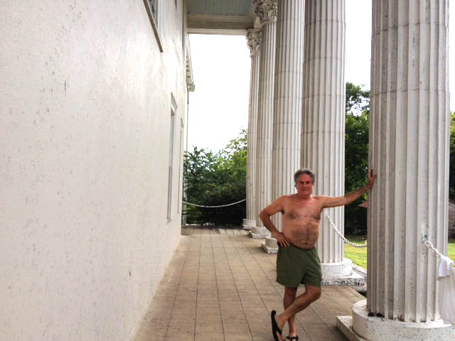
(photo by J.T. Wang)
And the rest, as they say, is PhotoShop. I took George out, and put the Band in and voila! - album cover location.
(inset photo by Stephen Paley)
By the way, the Wikipedia article on this album does not mention Steve Paley as the photographer of the front, inner sleeve, and back of the album, so if someone knows how to change that, that would be a nice tribute to Steve and these memorable photographs. The interior cover of the album cover depicts the band naked in a stream somewhere. I have not tracked down the stream yet, but I will look for a large pile of clothes on a riverbank and report back. 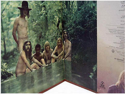
(photo by Stephen Paley) I did, however, find an outtake however that shows the guys after someone drained the lake they were in. I guess the showers were out at 309 College Ave. 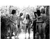
(photo by Stephen Paley)
The back cover of the album featured this photo of the band. The photo was taken at a lush, park-like, historic cemetery named Rose Hill Cemetery, near the band's house in Macon where they used to go to walk around, relax and get inspired. It is in this cemetery, too, that both Duane Allman and Berry Oakley are buried side by side.
(photo by Stephen Paley)
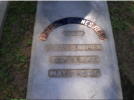
They went there so often, they named one of their most famous songs after one of the tombstones they would see there: that of Elizabeth Reed. The song is the familiar: In Memory of Elizabeth Reed. Elizabeth's tombstone can be seen below, via an image from a travel website called "Trip Advisor."
The back cover was taken next to a large burial space called The Bond Monument, pictured here, from the fan website called www.duaneallman.info 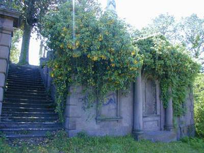
PopSpotted, the back cover would look like this.... 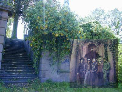
(insert photo by Stephen Paley)
The website mentioned above - www.duaneallman.info has extensive collection of photos of places the band frequented in Macon, and comes with map in case you ever want to make a visit. Some of the site and photos on the site are listed below (when he writes Bell House, I believe he is referring to the Beall House): 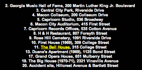
If you visit Macon, be sure to save some time to visit The Big House - the Official Museum of the Allman Brother's Band - located at 2321 Vineville Ave, Macon, Georgia 31204 (478-741-5551) (thebighousemuseum.com). It's full of memorabilia, including photos, posters, clothing, and musical instruments, and rooms made up to look just like when the Band lived there from 1970 to 1973. Here's a picture of it. 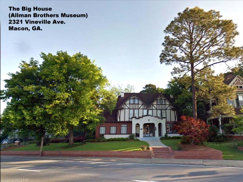
Shortly after the Bond Monument photo was taken in the cemetery, the photographer Stephen Paley, and the band took some more picture along the railroad tracks, that run next to the Cemetery, between the cemetery and the river. One of the resulting pictures ended up years later on the cover of The Allman Brothers Band - Gold from 2005, released by Mercury Records. (you'll notice they are all wearing the same clothes as when they were in the cemetery.) 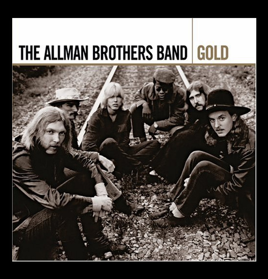
(photo by Stephen Paley)
Here you can see the band on the tracks and that they are wearing the same outfits.(PopSpots recommend NOT trying to replicate this photo as train tracks are dangerous) 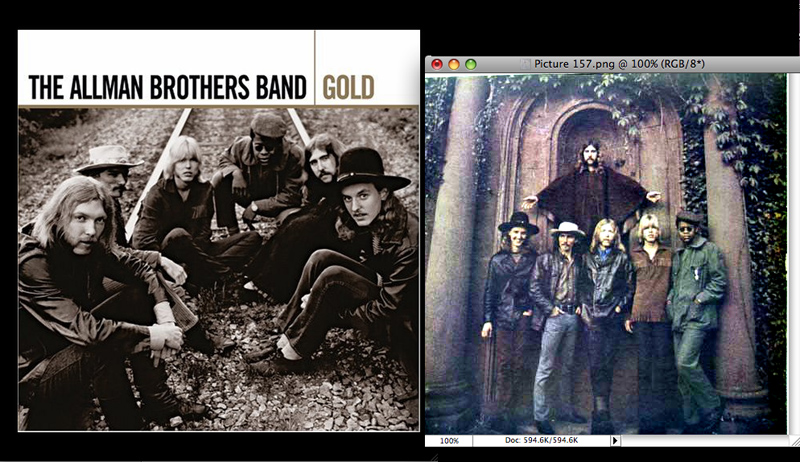
(both photos by Stephen Paley)
Here's a map indicating where the Cemetery is in relation to some of the other the other Allman sites in Macon. I've also listed the site for the cover shoot of The Allman Brothers at Fillmore East (1971). You can find that location and lots of photos of it at the PopSpot I made of that album. 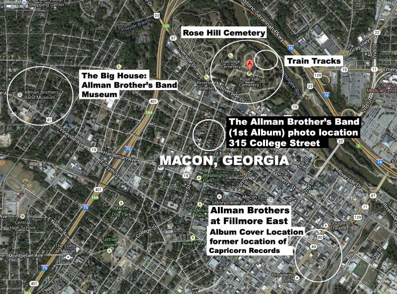
Now we come to the cover of the two-record set, "DUANE ALLMAN - an anthology" released in 1972 by Island/Mercury. On the cover Duane is fishing somewhere in the south, in what seems to be a swampy area. 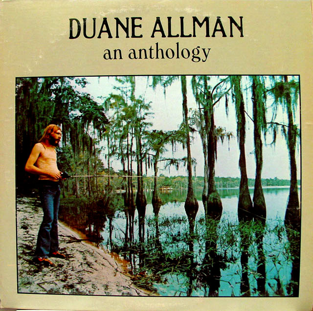
(photo by Stephen Paley)
Here's another outtake. 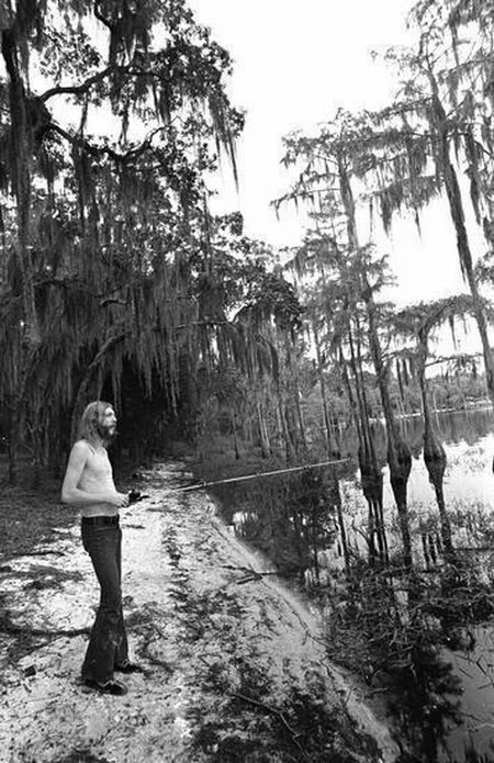
(photo by Stephen Paley)
And one from another angle. I still don't see any fish yet, so it's a slow day at the fishing hole for the fastest slide alive. 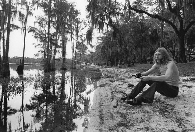
(photo by Stephen Paley)
On that same day, I am going to speculate, Duane had his photo taken with his brother Gregg in the current fashions. The clues here are it seems like it's a public park, since there are benches and tables. 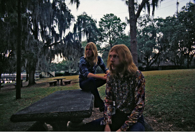
(photo by Stephen Paley)
Now in this photo, also found randomly in the web, Duane and Gregg are wearing the same pattern shirts as in the previous picture, at the picnic bench, but this time the rest of the band is with them, in an obvious photo-shoot. But where was it?? 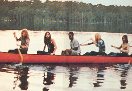
(photo by Stephen Paley)
There was a lot of speculation in Allman Brothers forums about this question, and the answers pointed me from Florida to Georgia, to Muscle Shoals, Alabama. But they also pointed me to a concert played at Florida State University in Tallahassee, Florida with the Mothers of Invention on October 9th 1970 in a venue called Tully Gymnasium. Here's the interior of Tully Gymnasium. (via Florida Memory) 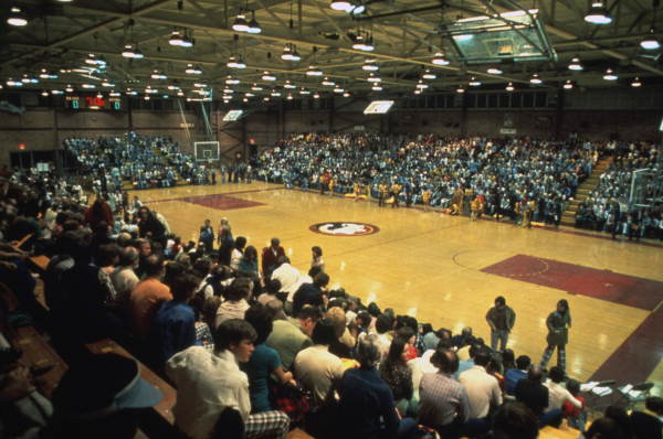
This is the Google entry saying connecting the Allmans, Frank Zappa, and Alice Tully Gym. on October 9th, 1970. 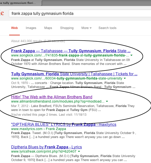
The same people who mentioned this particular weekend, also speculated that the photos were taken about 10 miles away at lake area owned by the University called Lake Bradford. It has the same type of cypress trees whose roots are in the water as were in the Duane/fishing pictures. 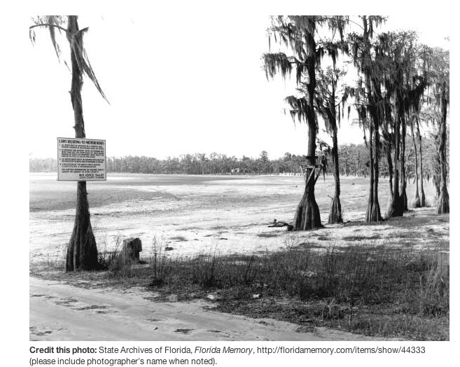
And another view... 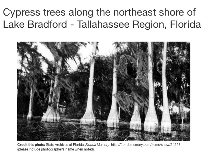
...and another. 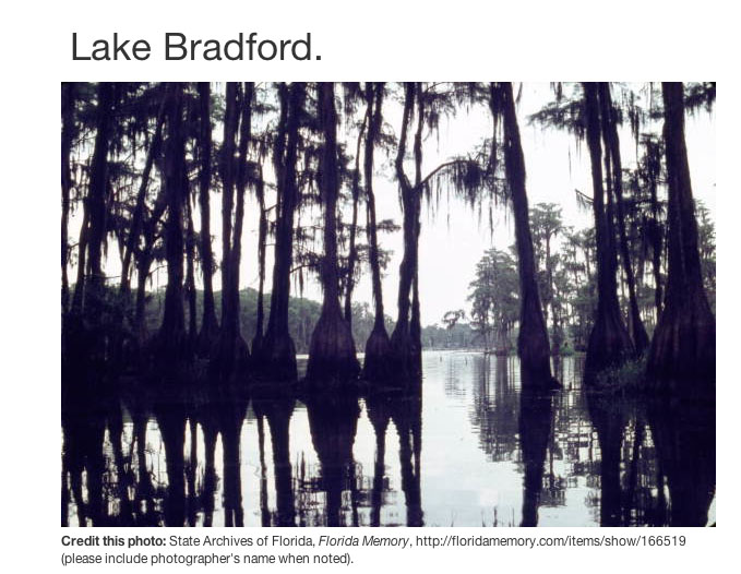
So, without knowing the exact spot Duane was in (if I can confirm this was actually the place, which it seems to be from the evidence so far) then matching up part of the shoreline and the cypress trees, the PopSpot comes out like this. .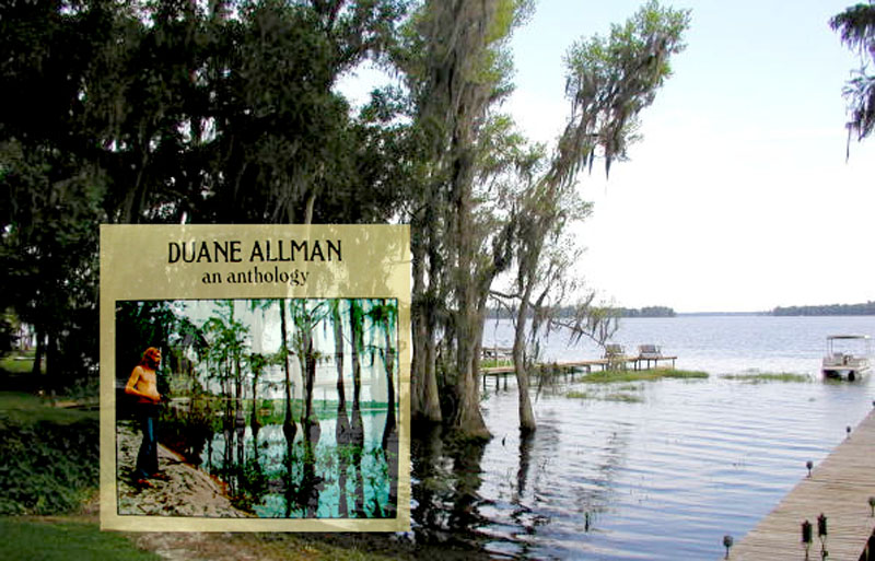
(Inset photo by Stephen Paley)
Here's an overhead shot of Lake Bradford. Notice that there are cypress trees in the water all along the northern and western shores. Duane might have been in any of those places. 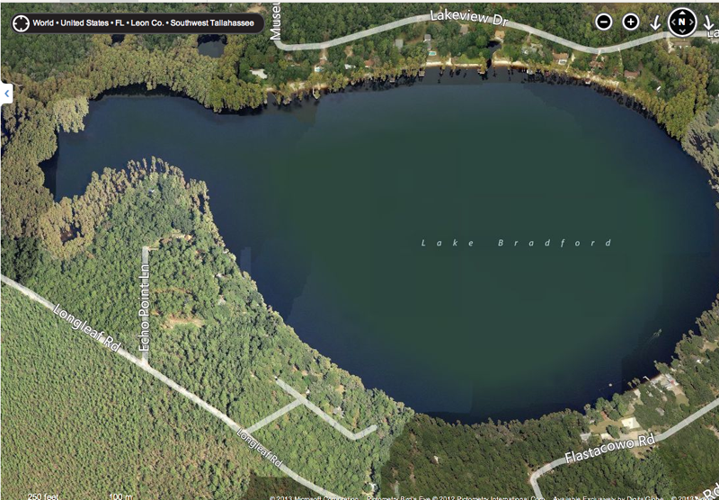
Here's a map of how close Lake Bradford was to the Florida State University campus where the Allman's were playing. 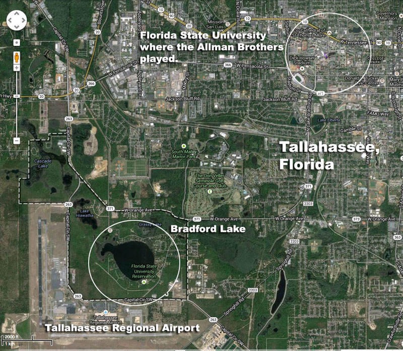
So that's my theory on the photo. We'll see how things develop as readers who know more read the entry and confirm or say it's someplace else -- in which case, I'll either be eating a peach or on the whipping post. Later, gators. UPDATE: JUNE 2017:THE LAKE BRADFORD LOCATIONS - CONFIRMED. In June 2017, PopSpot's reader John Clay of Tallahassee, Florida, who's very familiar with the Lake Bredford area, sent in this detailed description of the locations of all the photos taken in Lake Bradford. The location is unquestionably Lake Bradford, Tallahassee FL. The park photos featuring Duane and Greg were taken at the Florida State University Reservation (the Rez); there's absolutely no doubt about it. I've been in Tallahassee continuously since 1965. We went to the Rez frequently for picnics, swimming and canoeing from 1965 onwards. We water skied there with enormous regularity from around 1969 to ~1990. Our family owned and lived in a house on the NW corner of the lake for about a quarter of a century, roughly 1975 to around 2000, near the end of Echo Point Lane. From '69 to '75 we launched our boat from the Rez. From '75 on the boat was in the water at the house. My mother lived there until ~2000. Even now, having not been in the water there in this century, I can remember nearly every inch and every view of Lake B. I knew pretty much everybody who lived on the west side when I was much younger but some of the names are starting to fade and the people are long gone. Descriptions of notations on the map of Lake Bradford are below the map. 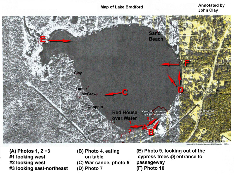
The first (album cover) and second photos were taken not far from the western boundary of the Rez, looking pretty much due west towards the homes of Dr. Michael Kasha, Dr. Raymond Sheline, and Mr. Gene Brown (all on Longleaf Road and in the order you'd pass them coming from Lake Bradford Road). Drs. Kasha & Sheline were world-renowned scientists at FSU (https://en.wikipedia.org/wiki/Michael_Kasha). In addition, Dr. Kasha worked with Gibson on acoustic guitar design (Kasha Guitar). Going there to hang out or go water-skiing with Nicholas often included seeing the latest guitar Dr. Kasha was working on. Dr. Sheline worked on the Manhattan Project in WWII I believe and Gene Brown was a real estate developer. The little red house over the water was a rental on Mr. Brown's property; it used to flood during occasional extended periods of heavy rain; come to think of it, the lake is fairly high in the photos. That corner of the lakefront is relatively high, up a fairly steep slope and had nice views. The Kasha and Sheline families are long gone, their kids flung all over the place. The third one is looking in the opposite direction towards the center of the Rez where the concrete dock (mostly gone now; only the stubs remain and can be seen from satellite photos), sailing club building, canoe building and the changing rooms were located. I can just make out the masts of the Flying Junior sailboats pulled up on the beach, adjacent the dock. The current satellite photo shows the general arrangement; there were other buildings farther up the property but they're long gone. The formerly flat observation roof of the sailing building is now peaked; that's a shame because it was a nice place to hang out. I'm a little surprised that there aren't any photos of the Allman Bros. up there. The tiny beach used for skiing is in between the sailboats and Duane; it was just a break in the trees big enough for the job. There should be a fiberglass cafeteria tray on the bottom, 50 or 100 feet offshore, that I tried to ski on once; I botched the takeoff and it sank. If anybody finds it, please close the loop here. The fourth, the color photo, showing both sitting on a table, shows the west end of the sailing club building with the steps to the observation roof. At the foot of the steps, adjacent the shrubbery, was the walkway to the snack bar with the women's changing rooms to the right; the men's being on the other side of the snack bar. A little farther east, near the property boundary, was the boat launch ramp and canoe building. You can see part of the dock as well. It was basically three sides of a square with a jog on the north section for the diving boards. It enclosed the swimming area. The fifth with the red canoe in the middle of the lake: That's one of two huge "war" canoes that they had at the Rez back then; I wonder if they still exist. They weren't part of the rental fleet of aluminum Grummans, but were stored in the canoe building which backed up to the east property boundary, adjacent the water. The photo looks west and the little white piece of a roof, just left of center, looks like the McGrew house. The Lamar house, single story and to the immediate right, was heavily wooded and isn't visible. Dr. Choppin's home was to the left of the McGrew's. He was another world famous scientist (nuclear chemistry, https://en.wikipedia.org/wiki/Gregory_Robert_Choppin); there's an interesting PBS video, featuring a supercharged VW bug, about the discovery of a new element by his team when he was at Berkley, on his Wikipedia page. I used to surf and ski with his son, Paul in the mid '70s. Sixth: That's Tully gym. I went to Florida High, across the street, and we lived about a quarter mile away from '65 to '69. Seventh: That's the east side of the lake, looking north. The beach in the distance is adjacent to the point at which Lakeview Drive is closest to the lake, in the NNE corner. The two-rut drive in the foreground is from the boat launch access that was part of a privately owned park that was located in-between the Gerald Drive intersection and the wye where Flastacowo Road (the entrance to the Rez) diverged from Lake Bradford Road; you can see an un-named road that doesn't (but used to) make it to the lake in between the two, in satellite photos; that's the road on the lake bed in the photo. The Levy family owned the park and retained the property after the park was closed down. As an operational venue I'm pretty sure it was dead by the early '70s though the buildings remained for 10 or maybe 20 years afterwards. Bill Heath welding was just across Lake Bradford Road. A friend of mine dated his daughter a time or two. "Have her back by 10" were his instructions. He wasn't the kind of fellow you doubted in such matters. Eighth: 1922! Who knows but it certainly could be Lake B. Ninth: That was taken looking East from just inside the passage-way which connects Lake B (across Little Sir Echo, the cove on the NW corner of the lake) to Lake Hiawatha. Tenth: I can't be certain but I'm reasonably confident it's Lake B. The cove in the distance is consistent with being Little Sir Echo. The three docks and what I can see of the waterfront are generally consistent with the little gaggle of docks that were there at the time. Somebody pulled the plug on one of the Ski Nautiques moored at one of them once. The location is in-between where Gerald and Cathedral Drives would intersect the lake perimeter on the East side, if they were extended to do so. If you zoom satellite photos you can get the gist of the shoreline. State Senator George Firestone had a house slightly south of where Gerald intersected Lake Bradford Road. Just to the north there were a couple of dirt roads between Gerald and Cathedral where a few old houses were usually rented for pretty cheap by FSU students; the parties there were legend. I had the Anthology album; wish I still did, along with all of my vinyl. In the un-cropped version of the war canoe photo that was in the album, (see below) the little sand beach at the extreme right border is where my parent's house was located. Those photos bring back a lifetime of memories; Lake Bradford, and the FSU campus for that matter, were central to our family, our lives and the lives of quite a few friends. I used to swim to the middle during intense rain storms 'cause you couldn't see 10' and it felt like being on a different planet. Water skied until we dropped, canoed every inch, watched many years of sunrises over the East tree-line, partied at our home, the homes of others and numerous other locations around the perimeter. It was a very cool place to be and to live in that era. 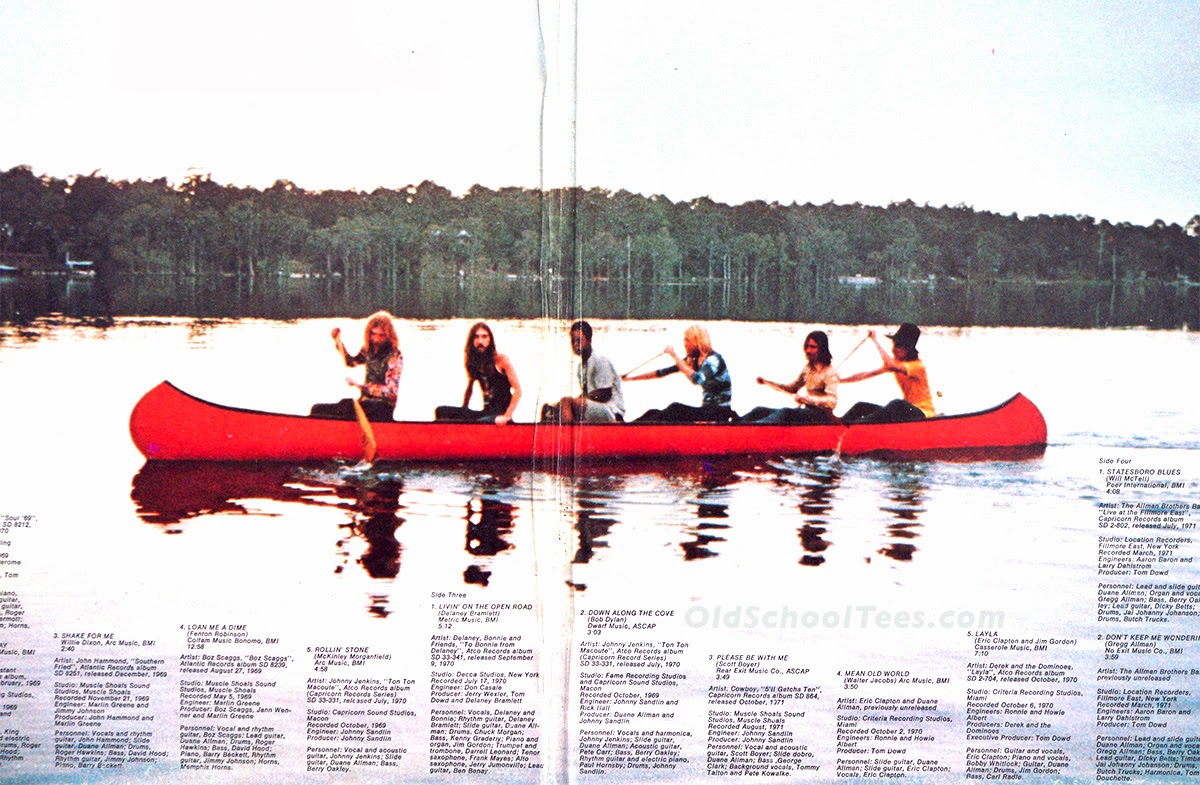
Those photos bring back a lifetime of memories; I mean we spent A LOT of time on that lake for a lot of years. Swam to the middle during thunderstorms 'cause you couldn't see 50' and it felt like being on a different planet. Water skied until we dropped, canoed every inch, watched many years of sunrises over the East tree-line, parties on the deck. It was home. I'm glad I can provide this information." Best regards, John Clay Tallahassee 
ADDENDUM - 1 Other famous album covers photographed by Steven Paley - # 1 (from Google Images) 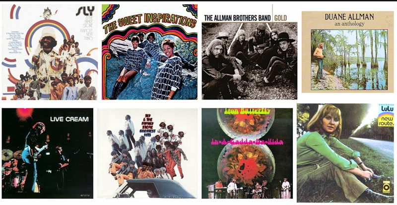
ADDENDUM - 2 Other famous album covers photographed by Steven Paley - # 2 (from Google Images) 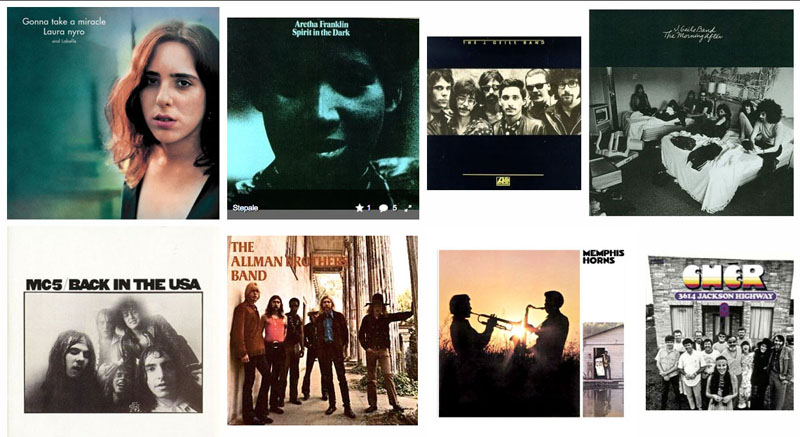
ADDENDUM - 3 PopSpots readers and Allman Brothers fans, the Cactus brothers (Mike and his brother (whose name I don't know), recently sent these pictures back from a tour they made to Macon. They visited The Big House museum and also visited other sites around town. Included is a nice ground-level view of the Rose Hill Cemetery, the former Capricorn Building, and 315 College Street. Thanks, brothers! Love that black-and-white, ground level shot at the Rose Cemetery. I don't know if you have a band, but you've got the look. Rose Hill Cemetery 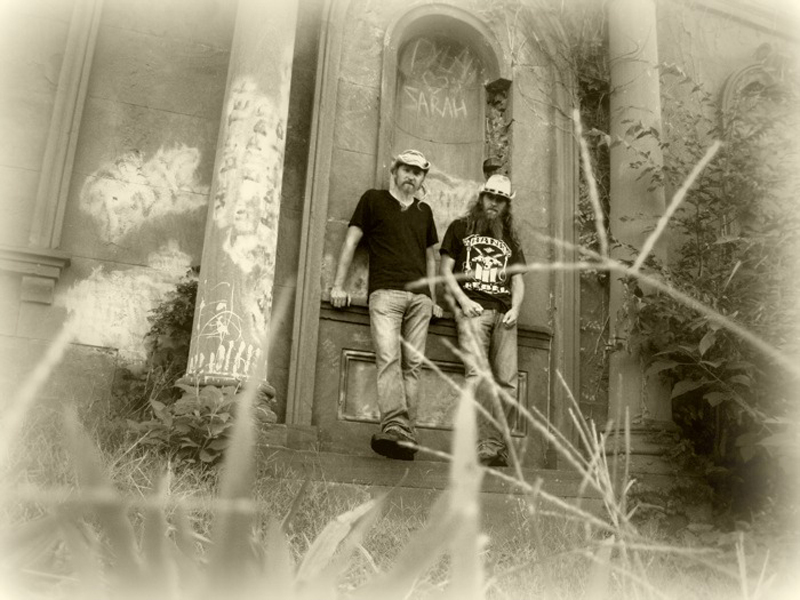
Rose Hill Cemetery 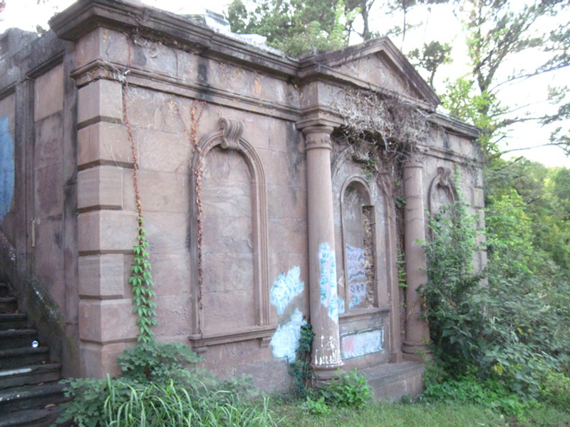
The former Capricorn site. 
On the porch of 315 College Street 
ADDENDUM - 4 Macon native and lawyer Jim Adams sent in this painting he made of the band at the Rose Hill Cemetery. Thanks, Jim. Nice job. 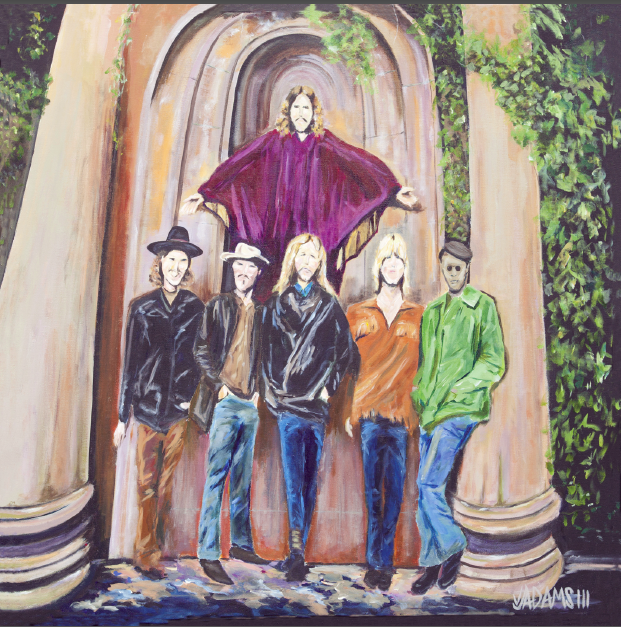
|
||